Understanding GPR Utility Surveys
Ground Penetrating Radar (GPR) utility surveys have become an essential tool in modern infrastructure management, especially in bustling urban environments like London. These surveys provide a non-invasive method to detect, locate, and map underground utilities, facilitating more efficient construction and maintenance practices. As cities evolve and infrastructure ages, the demand for accurate underground surveying continues to grow, making GPR technology increasingly relevant. For those keen on exploring GPR options in London, GPR Utility Survey London offers comprehensive insights into this innovative field.
What is a GPR Utility Survey?
A GPR utility survey employs ground-penetrating radar technology to produce high-resolution images of subsurface structures. The method uses radar pulses transmitted through the ground, which reflect off different materials, such as soil, rock, and utilities. As these signals return to the surface, they provide a detailed insight into the underground landscape, enabling surveyors to create accurate maps of existing utilities and potential hazards.
How GPR Technology Works
The basic principle of GPR involves emitting electromagnetic waves into the ground. When these waves encounter a boundary between differing materials, part of the energy is reflected back, while the rest continues to travel through the ground. By measuring the time it takes for the waves to return and analysing their strength, surveyors can infer the depth and structure of the buried objects. This method is particularly valuable for identifying:
- Water and gas pipes
- Electrical cables
- Drainage systems
- Concrete foundations and voids
Benefits of GPR Utility Surveys in London
The advantages of employing GPR for utility surveys in London are manifold:
- Non-destructive: GPR surveys do not require excavation, which means they can identify utilities without disturbing the ground surface, preserving existing structures and reducing environmental impact.
- Accuracy: GPR provides precise data on the location and depth of utilities, which is crucial for planning construction and maintenance activities.
- Cost-effective: By identifying potential issues early on, GPR surveys can prevent costly damages and delays during major projects.
- Time-efficient: The rapid data acquisition and processing inherent to GPR technology enable quicker project timelines.
Choosing the Right GPR Service Provider
Selecting a qualified GPR service provider is vital to the success of a utility survey. Various factors can guide your decision-making process.
Factors to Consider When Hiring GPR Surveyors
When evaluating potential surveyors, consider their experience, certifications, and the technology they employ. A reputable firm should possess relevant certifications and have demonstrable experience in conducting GPR surveys in urban environments. Additionally, inquire about the specific GPR equipment they use, as advancements in technology can significantly impact accuracy and efficiency.
Evaluating Reviews and Testimonials
Customer reviews and testimonials can provide invaluable insight into a company's credibility and reliability. Look for feedback on:
- Quality of work
- Adherence to project timelines
- Customer service and communication
Online platforms and industry forums can be great resources for gathering this information.
Comparing Service Costs for GPR Utility Surveys
While cost should not be the sole factor in your decision, it is crucial to obtain quotes from several providers to understand the market rate. Keep in mind that the cheapest option may not always yield the best results; assess the value of the service based on quality, expertise, and technological capabilities.
Applications of GPR Utility Surveys
GPR technology finds application across various sectors, making it an essential tool for many industries in London.
Construction Site Preparation and Safety
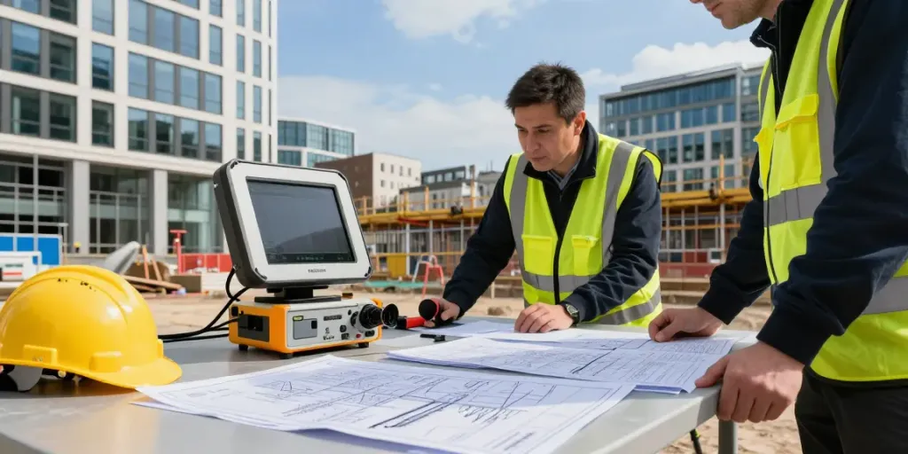
Before commencing any construction project, GPR surveys can help identify the location of existing utilities, thus preventing accidental damage during excavation. This proactive approach not only enhances safety but also minimises project delays. For example, construction teams can avoid hitting gas lines or water mains, which could result in severe accidents and costly repairs.
Utility Mapping for Infrastructure Projects
Public infrastructure projects benefit greatly from GPR utility surveys. By accurately mapping underground utilities, planners can develop more efficient designs that integrate with existing systems, thereby avoiding disruptions and optimising resource deployment.
Environmental Assessments using GPR
Environmental consultants often utilise GPR surveys to assess subsurface conditions before remediation or redevelopment projects. This technology can help identify contamination, buried waste, or other environmental hazards, facilitating more informed decision-making in environmental assessments.
Best Practices for Conducting GPR Utility Surveys
To maximise the effectiveness of GPR utility surveys, it is essential to adhere to best practices throughout the process.
Preparing Your Site for a GPR Survey
Proper site preparation is critical for accurate results. Ensure that the area is accessible and free of obstructions that could interfere with data collection. Additionally, coordinating with local authorities to identify any specific requirements for surveying in urban locations can streamline the process.
Understanding Survey Limitations and Challenges
While GPR is a powerful tool, it is essential to recognise its limitations. GPR may struggle in certain conditions, such as:
- Areas with high clay content, which can absorb radar signals
- Locations with complex geology that produces numerous reflections
- Sites with heavy surface clutter, which can obscure the data
A qualified surveyor can help mitigate these challenges through proper planning and methodology.
Interpreting GPR Results Effectively
Interpreting GPR data requires expertise and experience. Engage qualified professionals who can provide detailed analyses of the results, including the identification of various subsurface materials and utilities. Detailed reports should accompany the data, offering actionable insights for your project.
Future Trends in GPR Utility Surveys
The field of GPR utility surveys is continuously evolving, with several trends anticipated to shape its future.
Innovations in GPR Technology for 2026
Advancements in GPR technology are expected to result in enhanced imaging capabilities and improved data analysis tools. Innovations such as increased frequency antennas and advanced software algorithms will provide deeper insights and greater accuracy in utility detection.
The Role of AI in Utility Detection
Artificial Intelligence (AI) is beginning to play a significant role in interpreting GPR data. By leveraging machine learning, AI systems can learn from vast datasets, improving their ability to distinguish between different subsurface materials and identify utilities more accurately.
Predicted Changes in Industry Standards
As the landscape of utility surveying evolves, industry standards are likely to adapt to include stricter guidelines regarding accuracy, reporting, and technology use in GPR surveys. Staying informed about these changes will be essential for both service providers and clients.
How much does a GPR survey cost?
The cost of a GPR survey can vary significantly based on several factors, including the size of the area being surveyed, the complexity of the site, and the specific technologies used. On average, clients can expect to pay between £500 to £2000 for standard surveys in urban areas like London.
What are the advantages of using GPR for utility detection?
The primary benefits of using GPR for utility detection include its non-invasive nature, ability to produce high-resolution data, cost-effectiveness by preventing damage, and enhanced safety during construction.
Can GPR surveys be performed in all types of terrain?
While GPR is versatile, its effectiveness can diminish in certain terrains, such as those with high clay content, excessive moisture, or very rocky surfaces. Careful site assessment can help determine the feasibility of GPR surveys in various environments.
What is the accuracy of GPR in utility detection?
GPR can provide accurate results for utility detection, often achieving vertical accuracy within 10% of the actual depth. However, the accuracy can be influenced by factors like soil conditions and survey methodologies.
How do I prepare for a GPR utility survey?
Preparation for a GPR survey involves clearing the site of obstacles, communicating with stakeholders about the survey plans, and ensuring that all safety protocols are in place. Engaging with a professional surveying company can help streamline this process.